- A trail pass is required to access the winter trail system. See pass information here.
- Please no walking on groomed trails. Trails are for Nordic skiing, snowshoeing, and fat biking only.
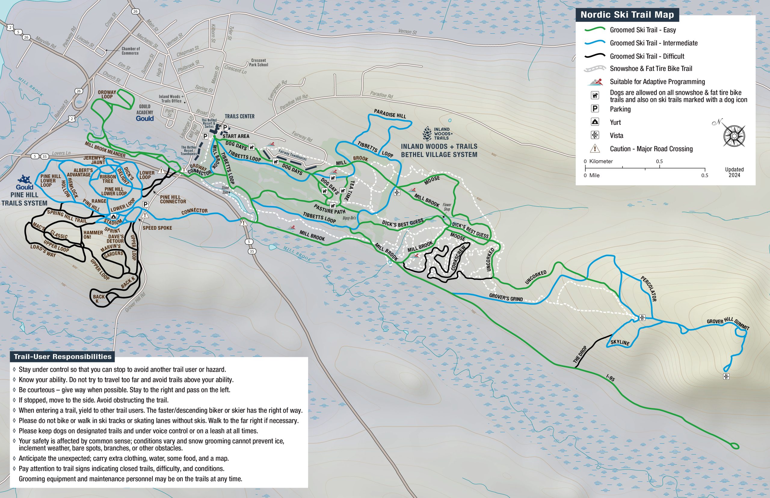
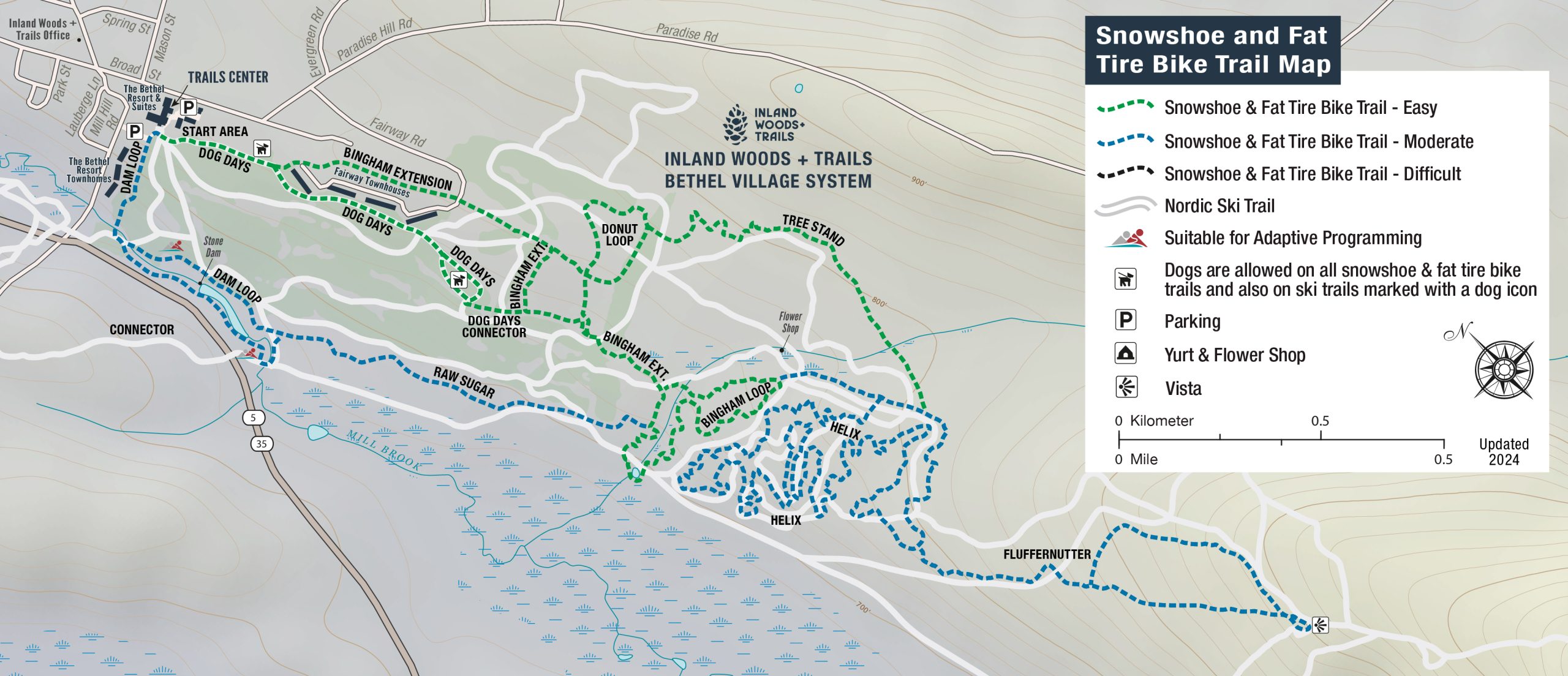
- Snowshoeing and fat biking share the same trails and are separate from the Nordic ski trails (with the exception of Dog Days). Please see maps below.

The winter trails center is located at The Bethel Resort (next to the Millbrook Tavern). We have a full rental fleet for skiing, snowshoeing and fat tire biking. We are happy to assist you with what equipment is best for your adventure. We also offer lessons for beginner and intermediate skiers–choose a group, private lesson, or join one of our clinics.
In 2016, Inland Woods + Trails assumed operations of the winter trails center at The Bethel Resort. This network now includes year-round recreation with a network of cross-country ski, snowshoe, and fat biking trails in the winter and mountain biking trails in the summer. This would not have been possible without the significant investment and volunteer contributions from our community. We are grateful to landowners that partner with us including private landowners and The Conservation Fund.
The connection: The Bethel Village Trails is at the core of IWT’s goal of community connectivity. The network provides recreation on the outskirts of Bethel Village, close to area businesses and not far from our other trail networks.


We are on Nordic Pulse! You can download the Nordic Pulse app to your mobile device to get updated condition reports and locate yourself on the trails.
Trails available & stats:
Fat tire bike and snowshoe: 9.36 mi
- Bingham Extension (easy) 0.91 mi
- Bingham Loop (easy) 0.8 mi
- Helix (intermediate) 2.86 mi
- Fluffernutter (intermediate) 1.17 mi
- Tree Stand (easy) 0.72 mi
- Raw Sugar (intermediate) 0.69 mi
- Doughnut Loop (easy) 0.56 mi
- Dam Loop (difficult) 0.83 mi
- Dog Days (easy) 0.74 mi
- Dog Days Connector (easy) 0.08 mi
XC Ski: 23.6 km (14.65 mi)
- Dog Days (easy) 1.3 km (0.78 mi)
- Tibbetts Loop (intermediate) 3.7 km (2.29 mi)
- Mill Brook (easy) 3.5 km (2.15 mi)
- Pasture Path (easy) 0.8 km (0.49 mi)
- Paradise (intermediate) 1 km (0.6 mi)
- Ordway (easy) 0.2 km (0.11 mi)
- Tea Time (easy) 0.2 km (0.14 mi)
- Harecut (easy) 0.2 km (0.11 mi)
- Dick’s Best Guess (easy) 1 km (0.65 mi)
- Moose (easy) 1.4 km (0.88 mi)
- Corkscrew (difficult) 2.1 km (1.33 mi)
- I-95 (easy) 2.7 km (1.68 mi)
- Grover’s Grind (intermediate) 2.7 km (1.7 mi)
- Uncorked (easy) 1.34 km (0.91 mi)
- Percolator (intermediate) 0.4 km (0.27 mi)
- The Drop (hard) .5 km (.3 mi)
- Skyline (difficult) 1 km (0.62 mi)
- Grover Hill Summit (intermediate) 1.2 km (.75 mi)
Rules:
- Bikers have the right-of-way on snowshoeing and fat tire biking trails
- XC skiers have right-of-way at all bike and ski trail crossings
- Dogs allowed on leash or under voice command on all bike/snowshoe trails and on certain ski trails indicated on the trail map.
- Bikes and snowshoers are not allowed on XC ski trails
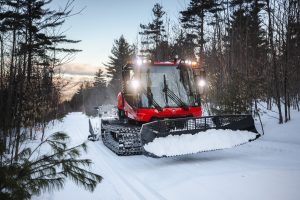
- Groomers may be present at any time on all trails
- Motorized vehicles are prohibited on all trails
- Active forestry may be occurring at any time
- Carry out all litter, including pet waste.
- No walking on the trails
- Trail pass is required
Maine Trail Finder links
Bethel Village Trails: Snowshoe and Fat Bike Trails
Bethel Village Trails: Cross Country Ski Trails
